Dear Travelers,
The profession of cartography and the use of maps are centuries-old traditions. In the Middle Ages, maps could include everything from the Garden of Eden to mysterious monsters warning travelers not to go there. Over time, the creation of maps has become less fantastical and based around theology, to becoming based in science. But that does not mean that the maps of the Middle Ages are now useless to historians?
Through the use of georectification and Geographic Information Systems (GIS), historians are able to superimpose historic maps on top of modern, interactive maps, allowing the historian (and the public they are sharing it with) to gain a better understanding of the history.
Why would historians spend their limited time, funding, and energy on using mapping tools? What is the point? These are the questions most historians ask. Using these types of tools requires hours of watching tutorials and learning how to do it correctly. When I was working on my map (which is only partially done), it took me almost three hours to understand what I was doing. The question of whether it is worth it for the historian to use digital mapping is dependent on the research questions and the methodologies they wish to use.
Contrary to popular belief, maps are not neutral parties. They depict not only the values and ideas of the mapmaker but also act as a snapshot of the time. If analyzed correctly, historical maps can not only shed light on political ideas, trade relations, and much more. Maps “do not simply objectively depict some external reality, but in fact create and sustain the world around us and our perspective of it.”
Some of the most popular tools for georectification (rectifying historical maps to where they match modern digital maps) is Map Warper, and for digital mapping are Google Maps and ArcGIS. I personally used ArcGIS for my project, but some may choose to use Google Maps because it is more accessible (it is free).
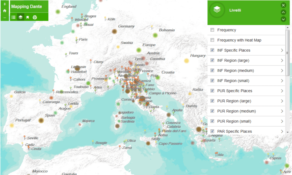
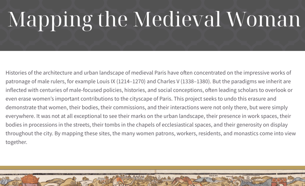
Historians use digital maps in multiple ways. Some use it to show where certain historical events took place. An example of this is Atlas électronique du Saguenay, Lac-Saint-Jean. Some use it to map where certain literature showed up in history, exemplified by the project Mapping Dante (left). Others, like me, use it to map where historical actors lived and how they were connected to others, shown by the project Mapping the Medieval Woman (right).
While historians tend to use these in their personal research, it is possible to send them to the public and receive public engagement. If one wishes to engage with the public with a GIS project, there are two options they can use: the top-down method or the bottom-up method. All of the examples previously mentioned consist of the top-down method, with the historian using GIS mapping in their research and then sharing it with the public. With this method, the historian holds all the power.
The bottom-up method is quite literally the complete opposite. This method allows the community to add information that they deem important to the GIS map. “Potentially, the impact and the importance of this new opportunity could be very high, because it gives a voice to groups, minorities, realities that do not feel sufficiently represented in the official historiography, and it can facilitate cultural innovation”.
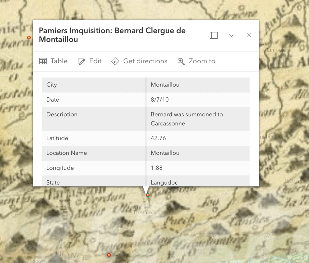
Now, what am I using ArcGIS for? I am using it to map those who were questioned by Jacques Fournier in the Inquisition at Pamiers. (Yes, I know I misspelled “inquisition” in the map…I wasn’t wearing my glasses at the time.) By using this method, I can visualize not only where people were located but also how they were in relation to each other, helping immensely with the prosopography.
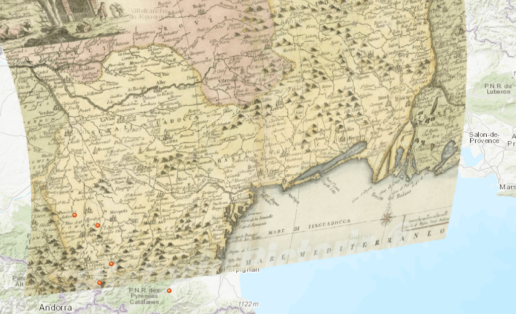
Overall, learning how to do GIS mapping was hard but worth every second! The ability to see where people are located, as well as the ability to georectify a map of 17th-century France to the map, is extremely helpful.
What do you think about GIS mapping? Is it worth the time?
Happy Travels!
Hannah ❤

Leave a comment